Browse Items (81 total)
- Tags: Trees
Jaycee Car Wash
Tags: Adults& Automobiles& Car washes& Children& Trees& Vehicles
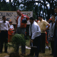
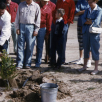
Richland Jaycee Tree-Planting
Richland Jaycee Tree-Planting
Van Geisen St. Extended, Richland, WA.
Van Giesen St. to West Richland looking west past Woods Nursery. Christian 8. Text on front of image reads: ""Van Geisen St. Extended. Richland , WA; Rob Johnson Christian 8"". Text on back of image reads: ""Van Giesen…
Tags: Columbia River& Floods& Nurseries (Horticulture)& Rivers& Roads& Trees
Hwy. 410 Between Kennewick and Richland
Entire area flooded. Text on front of image reads: ""Hwy. 410 - Between Kennewick and Richland; Rob Johnson Christian 7"". Text on back of image reads: ""Old River Highway - to Kennewick; 1948 Flood""."
Tags: Aerial views& Columbia River& Flooding& Roads& Trees
Entering Kennewick - Hwy 410
West Kennewick, flooded intersection at Fruitland Ave. and Columbia Drive. Christian 8-1. Text on front of image reads: ""Entering Kennewick - Hwy 410; Rob Johnson Christian 8-1""."
Tags: Aerial views& Columbia River& Rivers& Roads& Trees
Labor Yard - Richland, WA.
Geo Wash Way - Area where golf course is now located. Columbia Point Club. Christian 12-5. Text on front of image reads: ""Labor yard - Richland, WA; Rob Johnson Christian 12-5""."
Tags: Aerial views& Columbia River& Floods& Trees& Yard
Labor Yard - Richland, WA.
Geo Wash Way - Area where golf course is now located. Columbia Point Club. Christian 12-5. Text on front of image reads: ""Labor yard - Richland, WA; Rob Johnson Christian 12-5"". Text on back of image reads: ""Geo Wash…
Tags: Aerial views& Columbia River& Floods& Trees& Yard
Entering Kennewick - Hwy 410
West Kennewick, flooded intersection at Fruitland Ave. and Columbia Drive. Christian 8-1. Text on front of image reads: ""Entering Kennewick - Hwy 410; Rob Johnson Christian 8-1"". Text on back of image reads:…
Tags: Aerial views& Columbia River& Rivers& Roads& Trees
Van Geisen St. Extended, Richland, WA.
Van Giesen St. to West Richland looking west past Woods Nursery. Christian 8. Text on front of image reads: ""Van Geisen St. Extended. Richland , WA; Rob Johnson Christian 8"". Text on back of image reads: ""Van Giesen…
Tags: Columbia River& Floods& Nurseries (Horticulture)& Rivers& Roads& Trees
Richland Village
Tags: Business districts& Cities& Commercial streets& Department stores& Hotels& Parking& Rivers& towns& Trees
Columbia River 1948 Flood
Columbia River 1948 Flood
Columbia River 1948 Flood
Tags: Aerial photographs& Aerial views& Cities& Dikes (Engineering)& Embankments& Floods& Hotels& Levees& Lodges& Rivers& towns& Trees
Columbia River 1948 Flood
Columbia River 1948 Flood
Tags: Dwellings& Floods& Housing& Housing developments& Neighborhoods& Rivers& Roads& Trees
Columbia River 1948 Flood Protection Dike
Tags: Aerial photographs& Aerial views& Cities& Construction& Dikes (Engineering)& Embankments& Floods& Levees& Rivers& Roads& towns& Trees
Columbia River 1948 Flood
Columbia River 1948 Flood
Columbia River 1948 Flood
Columbia River 1948 Flood
Columbia River 1948 Flood
Tree-lined Building
Tags: Benches& Dirt roads& Schools& Trees
Brick House
Tags: Dwellings& Housing& Neighborhoods& Trees
HAMTC Union Picnic
Tags: Aerial photographs& Aerial views& Construction& Construction camps& Construction workers& Conversation& Discussion& drinking& Dwellings& Eating& Floods& Housing& Housing developments& Industrial facilities& Labor unions& Meetings& Neighborhoods& Older people& Organizations& Parks& Picnic grounds& Picnics& Retirements& Rivers& Trees


